Snapshot
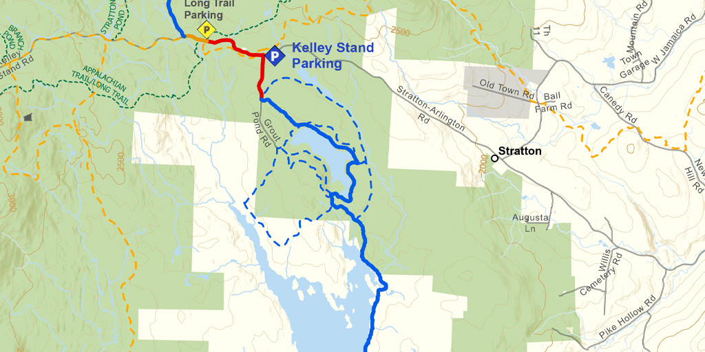
This is an un-groomed wilderness section offering views of Somerset Reservoir, Grout Pond, Stratton Mountain, and Mount Snow. The Trail briefly shares a snowmobile trail at the south end, and follows a road, sometimes plowed, for 0.5 miles at the north end.
Length
9.1 miles (14.65 km)
Difficulty
The terrain is easy but this is a very remote section with access points only at the south and north ends. Ninety percent of this section is ungroomed. At times winds coming across the frozen reservoir can create challenging snow drifts. Cell phone service is very poor on most of this section.
Staying Found
Out in the woods keeping track of where you are can be a challenge. A map and compass is always a reliable option, but there are some great technological solutions that can make knowing where you are super simple. Please visit out Staying Found Webpage for more info about some of our favorite navigational tools, and note that all of our PDF maps are geo-referenced. This means they can be opened directly in apps like Avenza and used for navigation even in areas where there is no cell service.
Catamount Trail Skiers Facebook Group
This group is for anyone planning any type of adventure (skiing and snowshoeing) on the Catamount Trail (thru-skis\end-to-end section skis\day tours), or other similar XCD/Nordic backcountry trails in Vermont. It’s a place to ask questions, share knowledge, and connect with others.
Downloads
Section 4 – GeoPDF Map
Section 4 – Written Description & Shuttle Directions
Your membership dues make CTA’s free online maps and trail descriptions possible. Please join CTA today!
Looking for more information, volunteer opportunities, or to get in touch with the Section Trail Chief? Please contact us!
Local Business Supporters
Lodging:
A Stone Wall Inn, 530 Hitchcock Hill Road, Windham, VT 05359
(802) 875-4238, www.astonewallinn.com, stay@astonewallinn.com
")