West Dover, VT
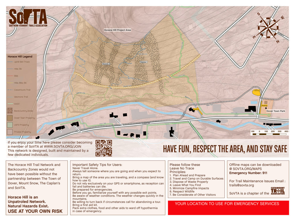
The Horace Hill trail and backcountry touring network is made possible through a partnership between the Town of Dover, the Caplan’s and SoVTA. There are currently four backcountry touring zones. Please be aware that the portion of trail shared with VAST Trail is likely to have snowmobile traffic. Safety is a primary concern on these shared stretches of trail. Snowmobilers cannot hear, and frequently cannot see, skiers and snowshoers before they come upon them. When skiing these shared stretches stay alert and be prepared to step off the trail at any time to allow snowmobiles to pass. Ski single file and to the side of the snowmobile trail. Keep dogs leashed.
Parking
Parking for the Horace Hill BC Zone is located off VT-100 across the street from TC’s Takeout – Map.
Staying Found
Before you head into the backcountry be sure to know where you’re going. Look at a map. Make some mental notes about the terrain, and make sure you have the tools and knowledge to get yourself safely back to you car at the end of the day. You can click on the image below to download a high-res jpg of the Dover Town Forest to keep on your phone.
Geo-Reference PDF Map – Horace Hill
This PDF map is geo-referenced for use with Avenza Maps. Using Avenza you can utilize your phone’s GPS to view your current location on on the map sans cell service or wifi.
Learn More About SoVTA
This terrain would not be possible without support from the community. If you like what SoVTA is doing Click Here To Learn More About Them, and consider becoming a SoVTA member, participating on a work day, or joining a tour!
")