NOTICE – Active Logging
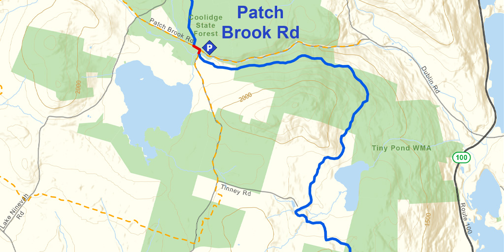
Active logging is taking place along a .3 mile long portion of Section 10 near Sawyer Hill Road. This operation will not effect access. However, it is possible that while skiing this section you may encounter the operation. If you do come across the logging operation please maintain a safe distance and alert the workers to your presence. Stay Safe!
Snapshot
This tour entirely a backcountry trail between Buttermilk Falls and Patch Brook Road. A steep, switch-backing ascent heading north from old Route 103 west of Buttermilk Falls turns to more rolling terrain through mixed hard and soft wood forests, much of it on old logging roads. The trail crosses a powerline (great for southbound turns in the right conditions), skirts beautiful Tiny Pond, and then contours around Tiny Mountain en route to Patch Brook Road.
Note: The connection between Healdville Station and Buttermilk Falls is currently a road walk along Station Road and Route 103. The CTA is scouting for an alternative to this roadwalk for through skiers. If you do not feel compelled to ski/walk every inch of the Trail, we recommend avoiding this walk and simply skiing between Buttermilk Falls and Patch Brook Road.
Length
7.8 miles (5.8 miles from Buttermilk Falls to Ninevah/Patchbrook Road)
Difficulty
This section is intermediate with a few difficult sections. Just north of old Route 103 there are a few steep slopes and sharp turns. Under icy or thin snow conditions, these steep sections require climbing skins or advanced descent skills. Otherwise the terrain is rolling. Northbound travel is recommended for those who prefer steep ascents to steep descents.
Staying Found
Out in the woods keeping track of where you are can be a challenge. A map and compass is always a reliable option, but there are some great technological solutions that can make knowing where you are super simple. Please visit out Staying Found Webpage for more info about some of our favorite navigational tools, and note that all of our PDF maps are geo-referenced. This means they can be opened directly in apps like Avenza and used for navigation even in areas where there is no cell service.
Catamount Trail Skiers Facebook Group
This group is for anyone planning any type of adventure (skiing and snowshoeing) on the Catamount Trail (thru-skis\end-to-end section skis\day tours), or other similar XCD/Nordic backcountry trails in Vermont. It’s a place to ask questions, share knowledge, and connect with others.
Downloads
Catamount Trail Section 10 – GeoPDF Map
Catamount Trail Section 10 – Written Description (.pdf ~148k)
Shuttle Directions Section 10
Your membership dues make CTA’s free online maps and trail descriptions possible. Please join CTA today!
Looking for more information, volunteer opportunities, or to get in touch with the Section Trail Chief? Please contact us!
Local Partners
Ninevah Foundation
The Ninevah Foundation conserves for public benefit more than 3000 acres around Lake Ninevah and Saltash Mountain in Mount Holly and Plymouth, Vermont. Section 10 of the Catamount Trail crosses Ninevah lands.
Forest Echo Farm
Forest Echo Farm is a community, with a unique history amidst 400 acres of Vermont wilderness. FEF is dedicated to preserving its land, maintaining a balance between its human presence and the natural character of each tree and mountain stream. Section 10 of the Catamount Trail crosses Forest Echo Farm lands.
Local Business Supporters
Lodging:
Scamper Inn, 1935 Lake Ninevah Rd., Mount Holly, VT 05758
(802) 259-2375, Scamper Inn Facebook


