The Bolton Backcountry is one of Vermont’s recreational treasures. The area consists of over 1200 acres of gentle birch and maple stands, steep glades, and narrow chutes. Much of the zone is over 3000ft and faces northeast. This, combined with consistent and significant snowfall, means that it’s hardly ever a bad call to spend your day exploring this part of Vermont.
With such a wealth and variety of terrain the Bolton Backcountry has something for everyone, whether you’re just beginning to explore the woods or a seasoned veteran. Our Bolton Backcountry Beginner Tour is just that… A great initial exploration of this area that is appropriate for backcountry explorers of any experience level.
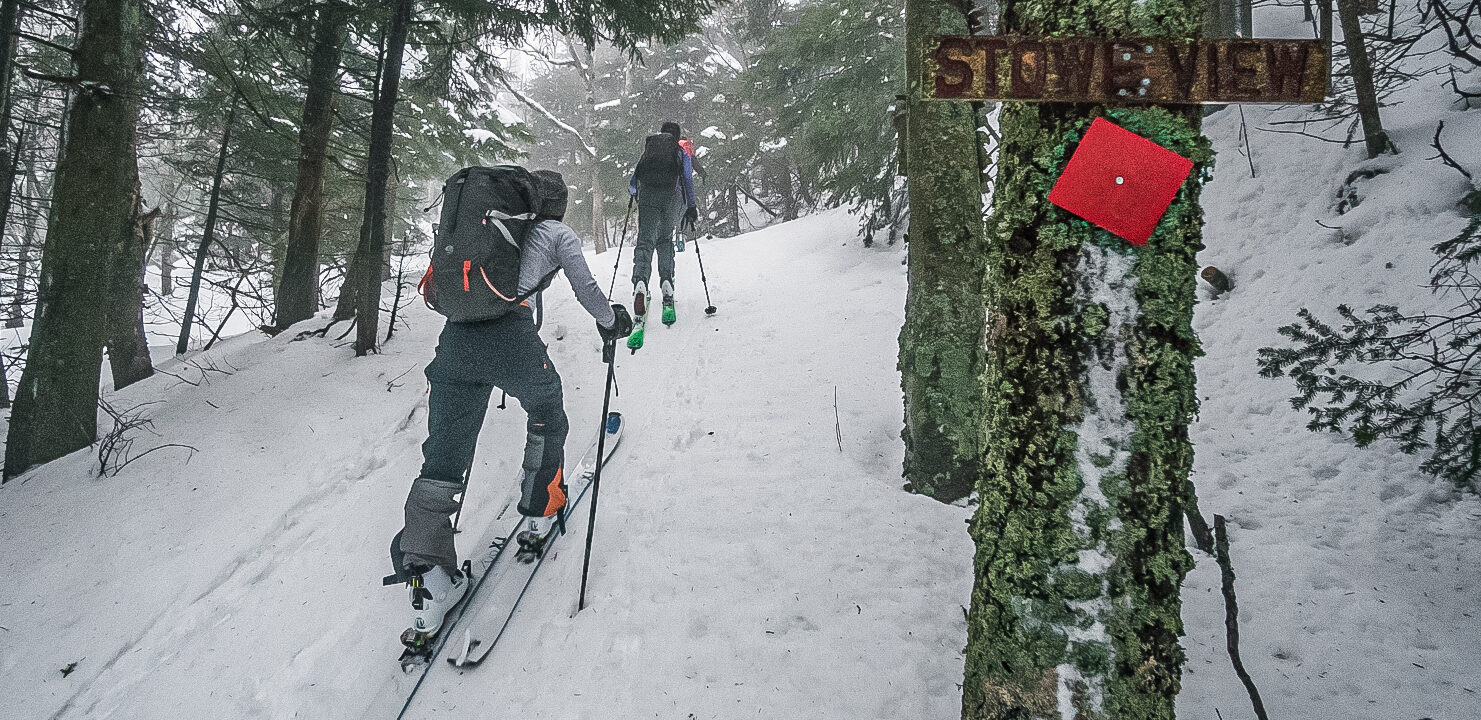
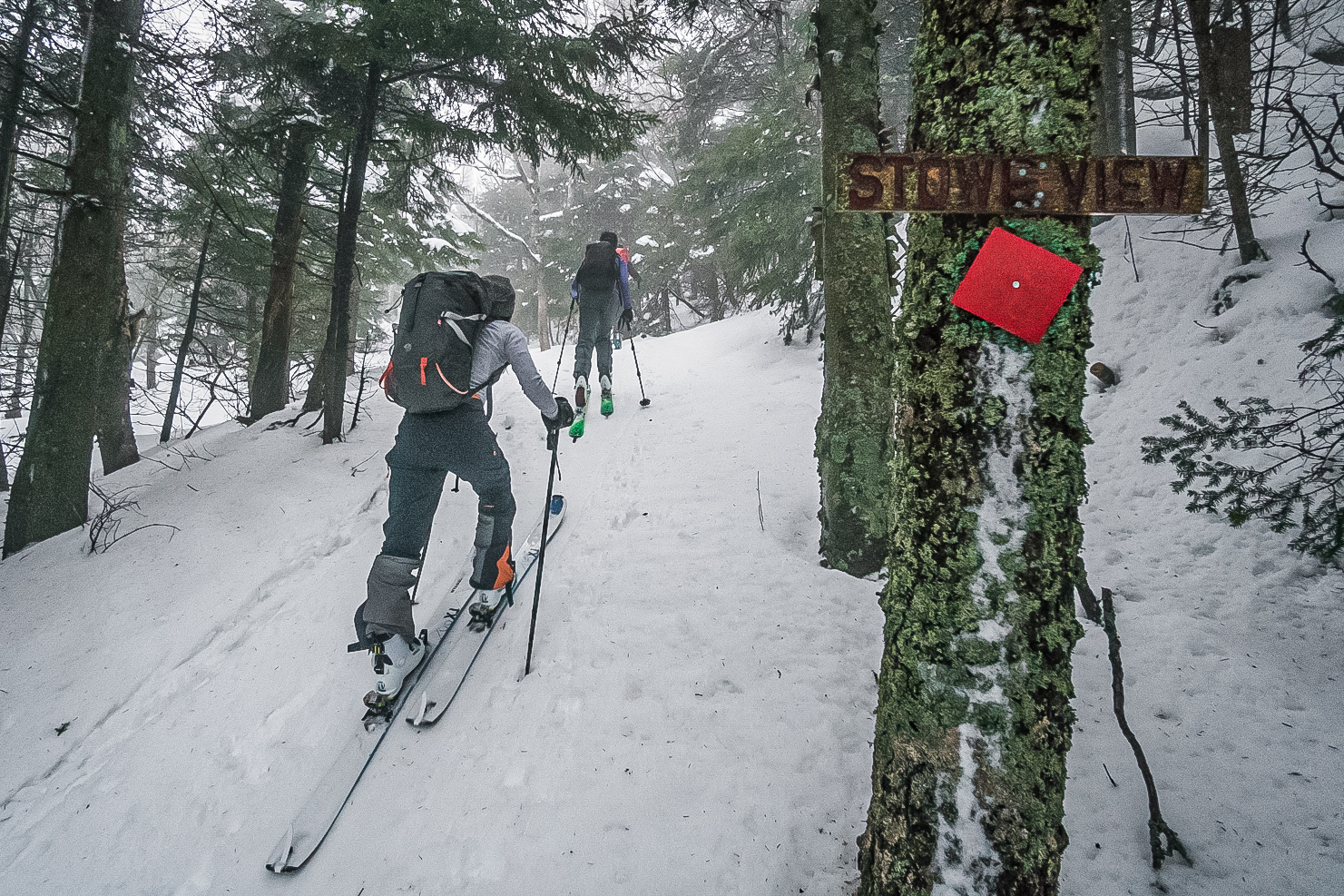
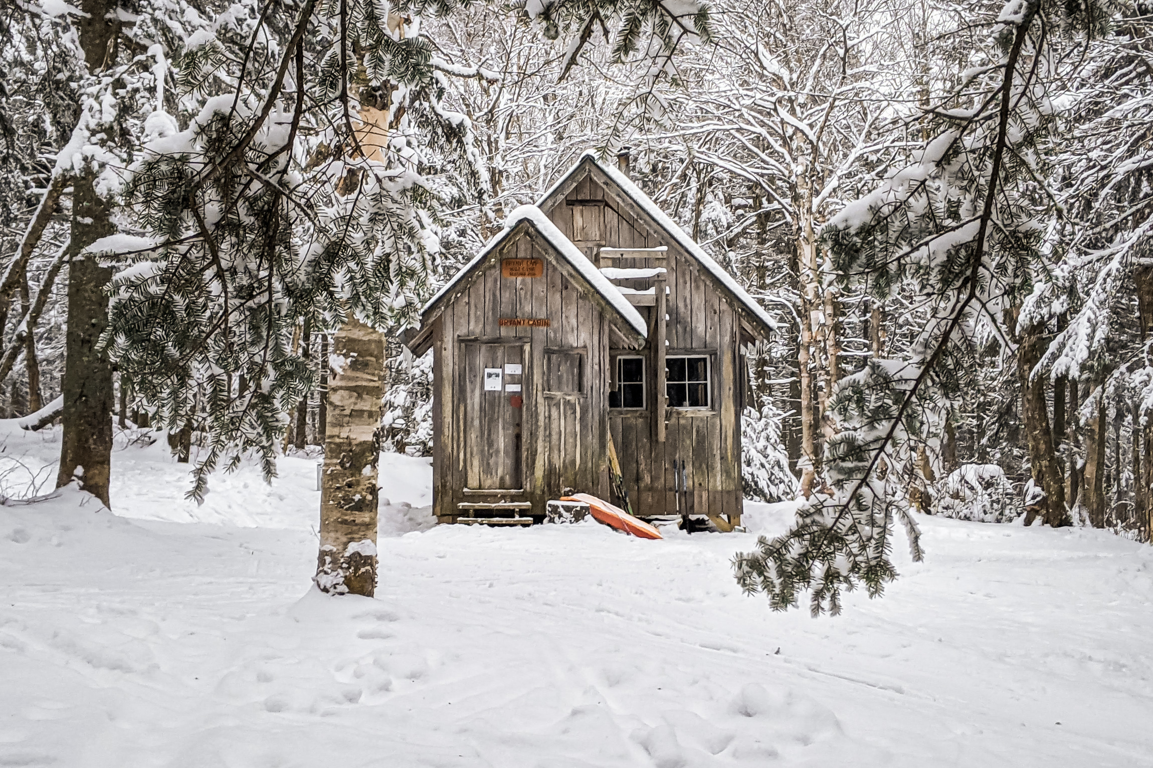
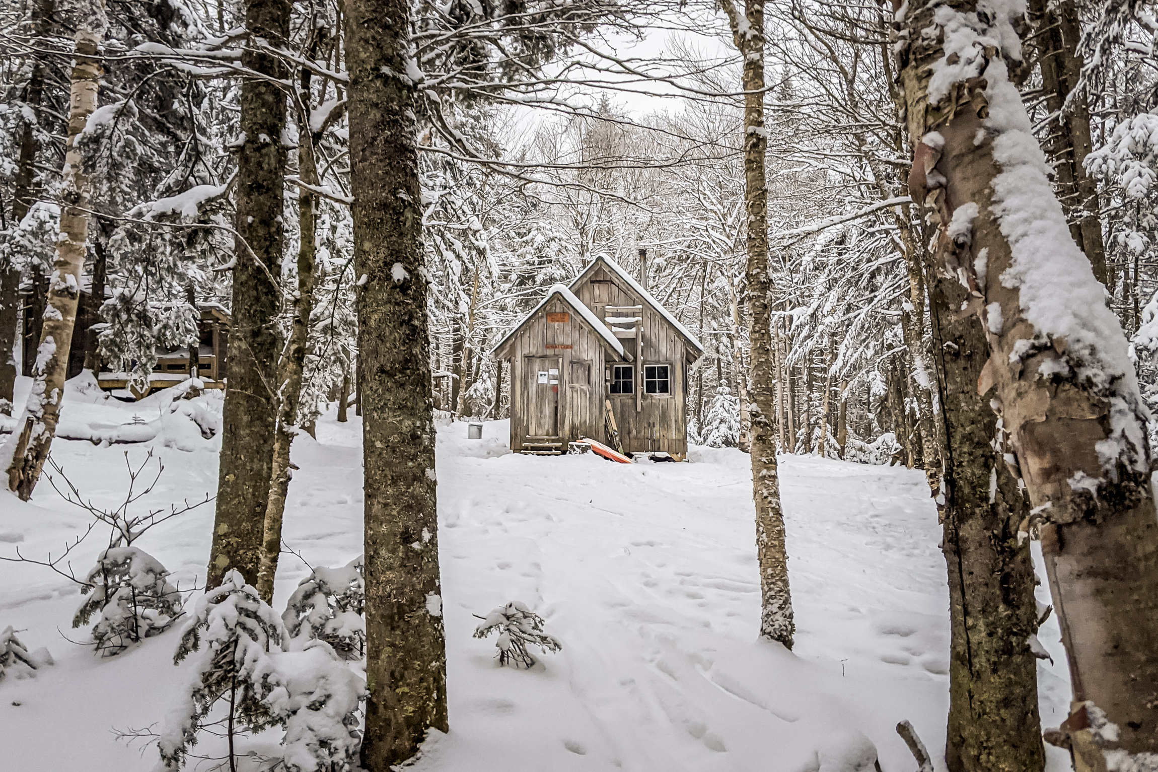
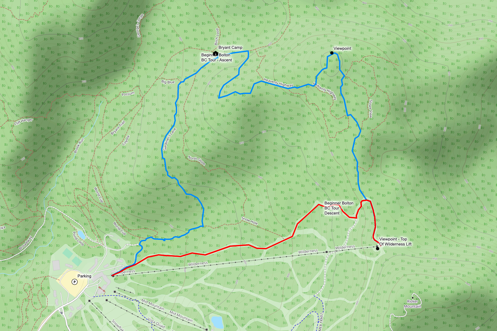
This tour begins at the base of the Wilderness Chairlift and climbs the Gardiner’s Lane Trail to Bryant Camp passing by a number of gentle beginner friendly glades. From Bryant Camp you will continue climbing along Heavenly Highway to Stowe View which offers incredible views to the north of Bolton Mountain and the Cotton Brook Valley. After taking in the views at Stowe View the route traverses south along the ridge before connecting with the Bolton Valley Alpine Trails. Once you reach the alpine trails you can continue on Peggy Dow’s to the top of the Wilderness lift following Bolton’s inbounds designated uphill route, or you can make the transition out of tour mode and descend on groomed, intermediate and beginner friendly trails back to the start.
Route Info
The Bolton Backcountry Beginner Tour is 4 miles long with 1200ft of climbing, and is appropriate for skiers or splitboarders. The descent is on groomed beginner and intermediate terrain. Appropriate equipment for this tour includes alpine touring, telemark, and splitboard setups.
Need To Know
Trail Fee
The Bolton Backcountry is accessed via Bolton Valley Resort and skiers and riders will need to purchase a Nordic/Backcountry/Uphill (NBU) Day Pass or have a season pass to access this terrain. You can purchase a NBU Pass on the Bolton Valley Resort Website, or at the Sports Center when you arrive.
Be Prepared
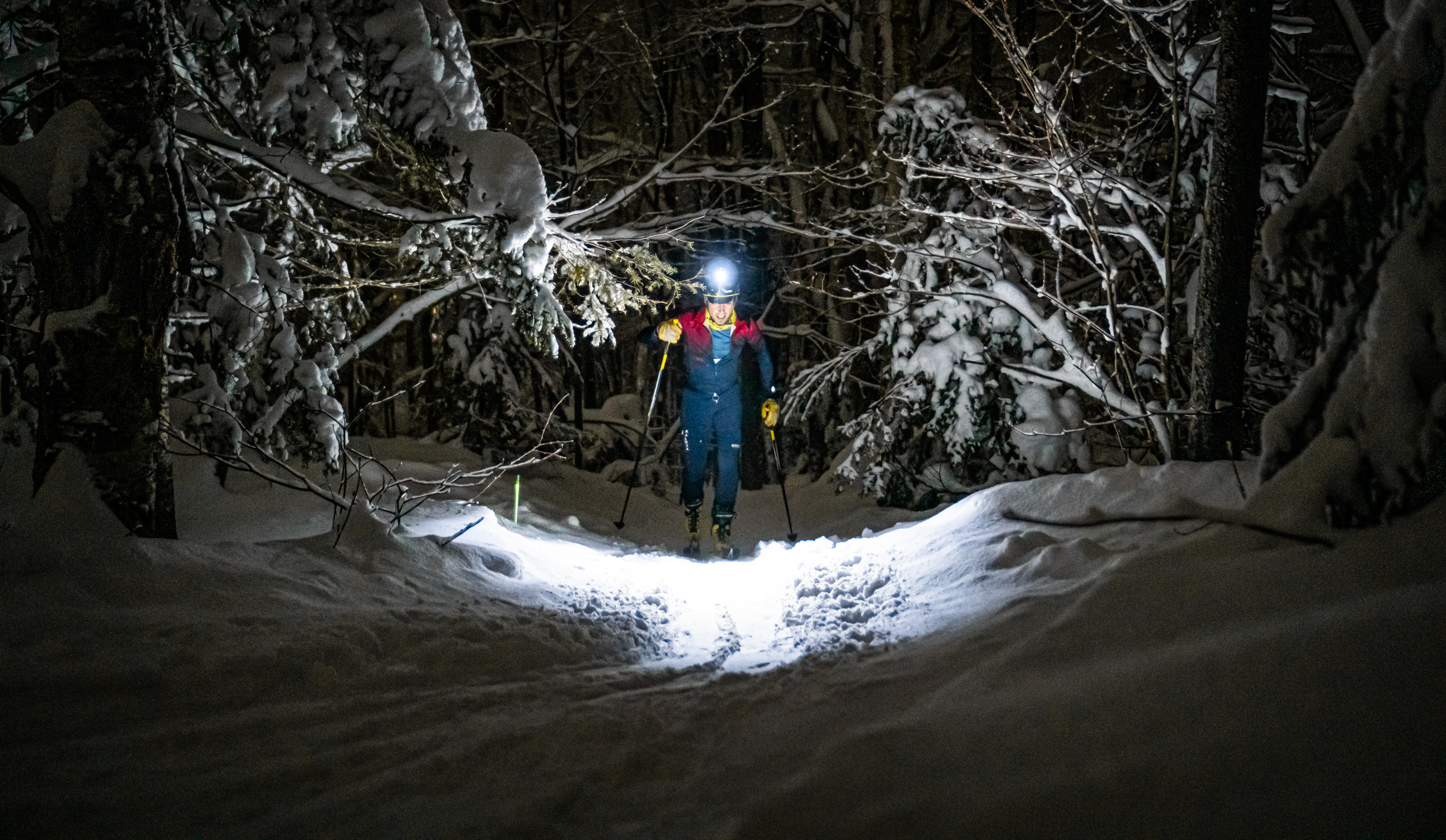
While this tour is easily accessed from a resort, you will be entering and traveling through a backcountry environment. You need to self-sufficient and prepared to help yourself. That means having the proper equipment, dressing properly, having extra food and water, and having a way to keep yourself found. Check out this List Of Recommended Equipment and stay safe out there.
Navigation Resources
Bolton Backcountry Route Map – View Route On CalTopo
Bolton Backcountry Trail Map – Download
CalTopo – LINK
CalTopo is a free online mapping service that has a lot of great tools for creating data rich maps. You can import GPX and KML tracks, edit these tracks, and export GeoPDF Maps when you are done. This Website has a great tutorial that covers how to make a GeoPDF Map in CalTopo for use with the free smartphone navigation app Avenza (learn more about Avenza).
Here’s the short version of how to make a map you can use to navigate in the backcountry even when your phone is in airplane mode:
- View the Bolton Backcountry Route Map on CalTopo
- Pick a basemap in CalTopo and any other data layers you want available
- Click Print to PDF and select the area you want printed, then save the pdf map to your computer
- Send the map to your phone using email, Dropbox, Air Drop, etc…
- Download and open Avenza
- Import saved PDF into Avenza
- Start Navigating!
If you would like to contribute a tour of your own please review our Submission Guidelines.
If you have questions… Contact Greg Maino at gmaino@catamounttrail.org.
")