Snapshot
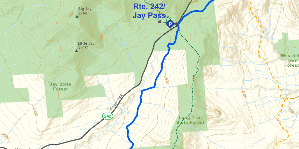
This section offers a variety of conditions and terrain, including nearly level groomed snowmobile trails, logging roads, and steep, narrow, twisting hills. Snow is usually reliable and deep due to a northwest exposure. The ridge below Buchanan Mountain offers fine views of Jay Peak to the north and Burnt Mountain to the south.
Length
6.5 miles (10.46 km)
Difficulty
With a flat middle portion, and steep, twisting, ascents/descents at the north and south ends, this section requires an intermediate to advanced level of skill. Metal-edged backcountry skis are essential. Bring skins in case conditions are icy.
Staying Found
Out in the woods keeping track of where you are can be a challenge. A map and compass is always a reliable option, but there are some great technological solutions that can make knowing where you are super simple. Please visit out Staying Found Webpage for more info about some of our favorite navigational tools, and note that all of our PDF maps are geo-referenced. This means they can be opened directly in apps like Avenza and used for navigation even in areas where there is no cell service.
Catamount Trail Skiers Facebook Group
This group is for anyone planning any type of adventure (skiing and snowshoeing) on the Catamount Trail (thru-skis\end-to-end section skis\day tours), or other similar XCD/Nordic backcountry trails in Vermont. It’s a place to ask questions, share knowledge, and connect with others.
Downloads
Section 30 – GeoPDF Map
Section 30 – Written Description & Shuttle Directions
Your membership dues make CTA’s free online maps and trail descriptions possible. Please join CTA today!
Looking for more information, volunteer opportunities, or to get in touch with the Section Trail Chief? Please contact us!
Local Business Supporters
Lodging:
Jay Village Inn & Restaurant, 1078 Route 242, Jay, VT 05859
802-988-2306, www.thejayvillageinn.com, info@stayatjay.com
")